Giving the River Back to the City — Meeting Jorge Pérez Jaramillo at Medellín's River Park
The Río Medellín, the city's lifeline, ran for a long time with the city's back turned to it. The riverbank was merely a space of functional infrastructure — expressways, railways, trucks — not a place a citizen could walk up to. The project that set out to reverse that relationship is Parque del Río Medellín (the River Park).
On 8 July 2024, we walked the River Park with the very person who designed and drove the project — Jorge Pérez Jaramillo — and reproduce the conversation here almost verbatim. As Medellín's Director de Planeación (chief planner) from 2012 to 2015, he led this project and the city's 2014 land-use plan (POT); today he is an architect and urban planner heading MDE Urban Lab. What follows is the on-site recording of a walking interview along the riverbank, lightly cleaned up.
Setting — Walking the Riverbank Together
This was not an interview arranged with questions exchanged in advance. On 8 July 2024, it was a live conversation held while actually walking across the deck of the River Park that covers the Río Medellín. Jorge stood on the bridge and pointed across to the far bank, walked past flowerbeds planted with native species, and explained, on the spot, the urban transformation that had unfolded there. The exchanges below are an almost verbatim record of that walking conversation; the interviewer's questions have been naturally restored from the topics Jorge answered, and the questions actually asked on site are kept as they were.
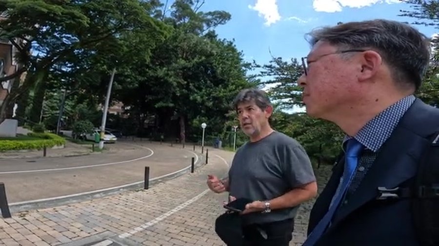
Jorge introduced himself this way: "Jorge Pérez Jaramillo, I'm an architect, an urbanist. I was the chief planner when this project, Parques del Río, was built from 2012 to 2015. I have been also a practitioner, academic and private worker in this city of Medellín for many, many years now."
① The Rupture Between River and City, and Their Reconnection
Traditionally the river was a functional area, just for highways, for trucks, for trains, for things like infrastructure, for machines. It was also infrastructure for energy supply, water provision, gas, everything. During many, many decades and the history of the city, it was a kind of mechanical infrastructure.
And now it's a neighborhood connected with the city through a park. So that's the difference. So it's the first time the public understands the river as a park, as a place for life, not only as a functional place.
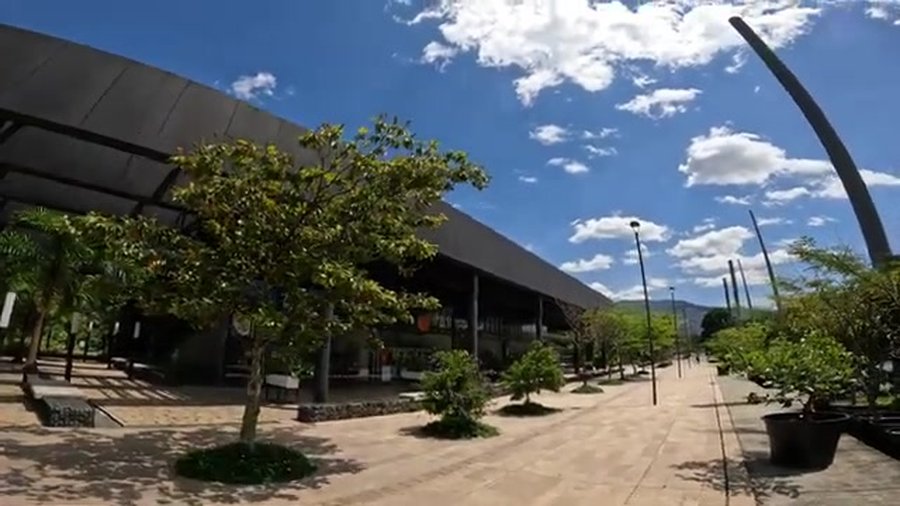
This actually means the transformation of the whole city into a place leaded by urbanism. Urbanism understood as a way of building the cities as places for life. Our mayor used to name the project we lead as Medellín, a city for life.
It's a very inspirational thing, because in times of climate change, we need to understand that building a city is also an environmental and healthy issue, not only a functional issue. So this project also means the rediscovering by the citizens of the river. We understand we are a city with a river for the first time in many years.

② The First Pedestrian Bridge, Linking East and West
This is the west side, and it connects the east and west side of the city. It's the first project ever to connect both sides, for pedestrians or for bikes. So it's the first time citizens can cross the river area walking, biking. Where we are standing is one of the first pedestrian bridges ever.
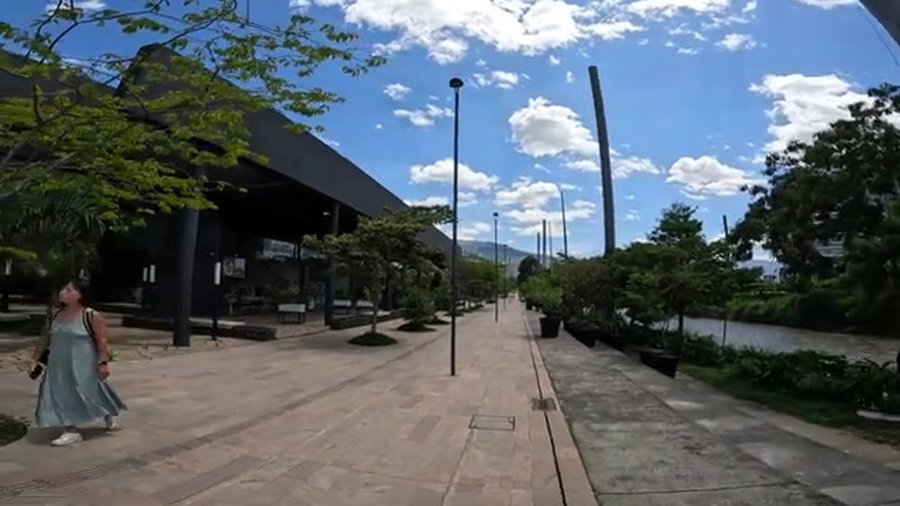
That building is the metropolitan theater. For the first time this barrio, this neighborhood is connected with the theater. So they can walk to the theater. Before, they used to go by car, going a long way to get to the theater that is right in front of the houses. And next to it there's the fair — we call it the fair of expositions — the place where the exhibitions and the commercial fairs are held.

③ 57 Teams, an International Competition, and a Young Medellín Team's 'Botanic Park'
This project was a competition, an international competition. We had 57 participants worldwide, from four continents. And the winners were young architects from Medellín. It was a surprise.
Their approach was to build what they call a botanic park. So they use traditional local species for everything. New trees, new gardens are completely designed with local species.
④ Native Species and Ecology — Drawing Fauna and Flora into the Inner City
The idea was to attract fauna, flora, new species for the inner city. When you design the gardens with local native species, birds and insects and plants come back into the city. So this is the biggest public space and park area built in Medellín in 50 years or a century.
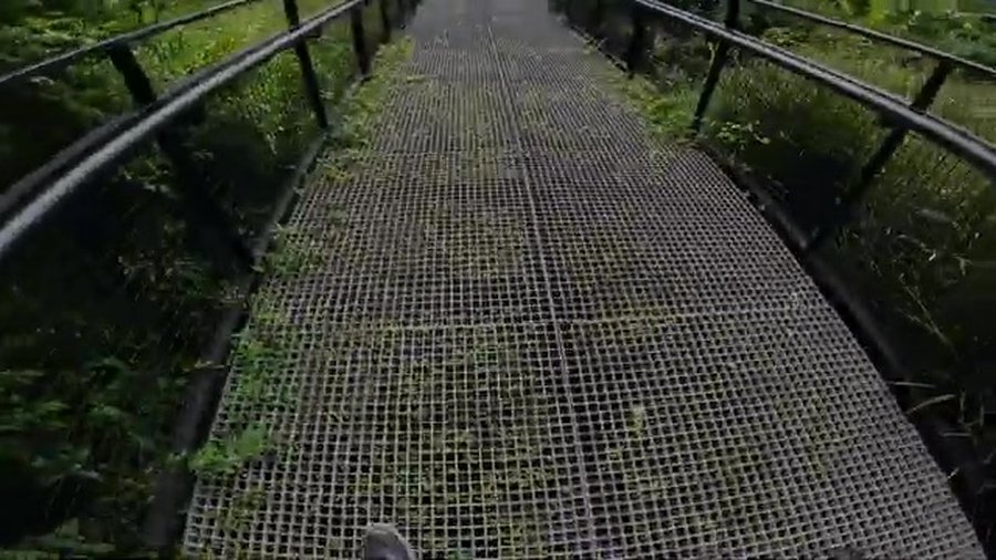
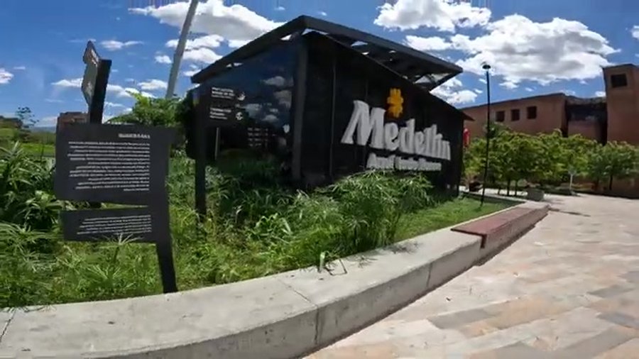

These trees were like this even when the project was built. But now they are over an expressway. You have an underground highway right here. So the cars are below us, and you have the trees above.

⑤ Bikes, Services, a Soccer Field — Simply a Place to Stay
Yes, you can use a bicycle. Everything is connected by bikes.
There's a small soccer field, and you have services — bathrooms, restaurants, cafes and so on. This is the building for restaurants, coffee, services. Today is Monday, so it's the day they close the restaurants, but the whole week it is so crowded, because people love it.

Those games are used not only by kids but by elder people to make exercises. Normally, earlier in the morning, you see a lot of senior people making their exercises. This is a place for families, for enjoying your free time. It's a green area, it's an ecological connectivity infrastructure, but also a place for doing nothing — in the sense that you have to have places in your city to do nothing, to see the birds, to feel the air, to just stay.

⑥ An Ecological Corridor Reaching to Nutibara Hill and Protected Areas
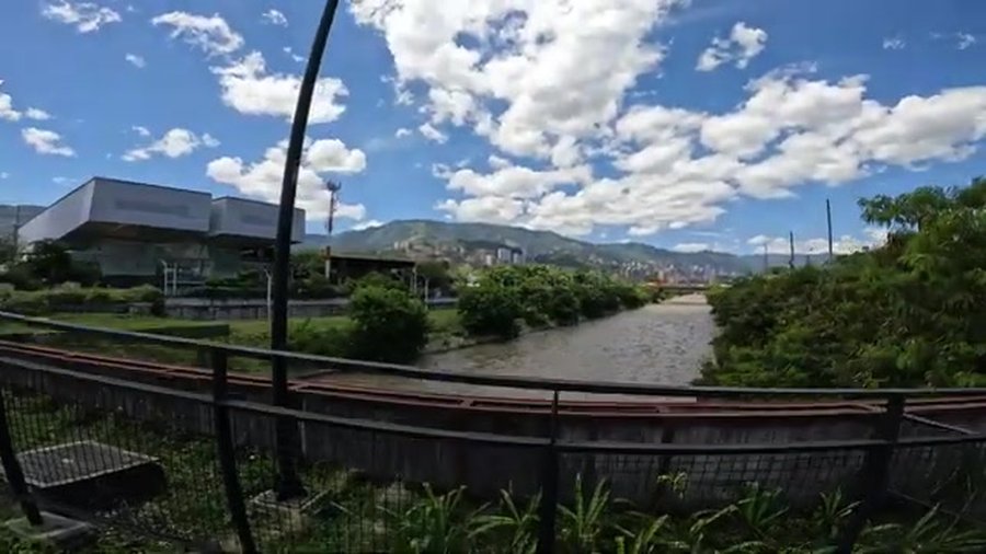
That is the Nutibara Hill, that green area. It's a protected natural area, so it's a park. The riverside park connects with these guardian hills and forms an ecological corridor.
That building is the fair of exhibitions, the convention hall. And everything flowers — in this city, everything flowers.
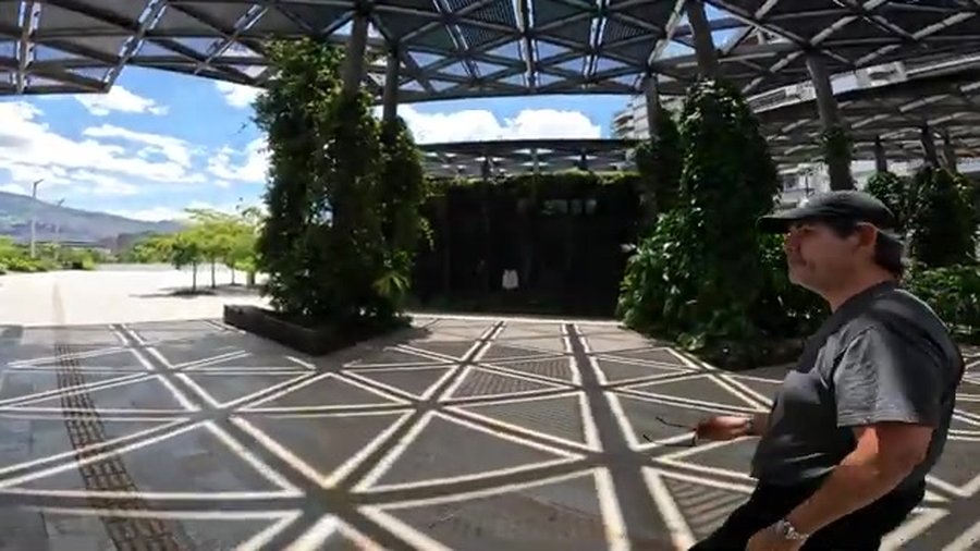

During the weekends, you see a lot of families in the green area — with the dogs, with the families. You have restaurants and places for the people, and the riverside becomes a stage for leisure.

⑦ Thirty Years of Water Recovery, and a Reconciliation of River and City
I think most of the cities of the world must recover their relation with the water. There is no justification to have the rivers abandoned as just the places for highways. A mayor who visited this city recently has taken the renaissance of the riverside as his own project. Water is really important.
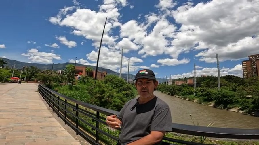
It's different. Even though we can flood sometimes, flooding is not the main problem here. So we are safe to have a relation with the river. But in Seoul you have a big river, so it's more difficult, and the complexity of hydraulic and hydrologic problems is higher.
The recovery of the river's pollution has taken us 30 years, and it's still 80% successful. So we still have to work a lot to recover completely the quality of the water.
There's a funding project that started back in the 90s — since that moment, every citizen has paid a monthly tax for the sanitation of the river. So there's the money. The problem is the geography of the valley: there are a lot of streams that come down from the mountains, so the city has completely transformed the collectors of water along their way. But there's still a lot of work to do with the barrios, the neighborhoods on the borders, to recover the quality of the water completely.

The technology we have used for the sanitation of the river includes Hyundai Company technology. There has been a strong collaboration of Korea for this sanitation process. We use tunnels for the infrastructure with technology from Hyundai. And that's the headquarters of EPM, the main company for facility services in the region. It's the second largest company of the country, and it's completely public, completely owned by the Alcaldía de Medellín, the city of Medellín. More than 90% of water provision, energy provision and telecommunications provision in the city are by EPM.
⑧ Who Manages It, and How It Is Funded
EPM is a company owned by the municipality, so it's completely under the rule of the mayor and the planning authorities of the city. When I was chief planner of Medellín, for example, I was a member of the board of EPM, because by regulation every chief planner of the city is part of the board of EPM. So they are independent, they have autonomy, but there is a dependency from the alcaldía, the city hall authority. So planning is always simultaneous between EPM and the city. They are very, very powerful in terms of resources, and they support the alcaldía in many ways.
The Alcaldía — the city hall. And the budget comes from the taxes that the citizens pay. But the other phases of the project — because there are several phases — are funded through urban redevelopment areas. So the real estate companies have to pay some contributions to build the next phases of Parques del Río.
Parque del Río, as I said, is a master plan of a project some 17 kilometers long, and it is one of the main public spaces that includes programs for the young kids and the elderly. We have institutions like INDER, the Institute for Recreation and Sport, and the Alcaldía provides services to the people through that institution. EPM also owns a foundation, Fundación EPM, that supports public spaces, green areas and river parks. When we work on these kinds of public spaces, we think about building a type of life for the people — integrating climate change challenges and SDG objectives, all through the planning office.

⑨ 'A City for Life' and Proximity Planning
I like to call this not a project, but a strategy. Because it's a strategy for public space, it's a strategy for ecological connectivity, it's a strategy to reconnect infrastructures for the regional transportation system, it's a strategy to build a new train line that will go along the river from north to south. But it's also a place for life, it's a place for the people — in a city where you have a very, very strong deficit of green areas and public spaces for the people.
From this place you have these beautiful views over the valley. You see almost the whole valley from here. Normally there is water. Today is a Monday, so it's empty, but during the week, in the afternoon and in the evening, you have a lot of kids playing with water in this fountain that is called Chorritos. And you feel the noise again — you can hear it. That expressway runs below. That expressway is right below us.

For us as architects, urbanists and engineers, it's fantastic to understand the power of urbanism — projects like this transform the life of the people, but also the economy and the quality of life. It's a very transformative power of urbanism to create new conditions for society. I don't understand why it's so difficult to convince politicians and some leaders about the importance of that, because you invest millions and millions of dollars in infrastructure for cars, and the investment you need in public spaces like this is just a little bit of that. Even though this can be an expensive project, the equation between cost and the value added for the people is unbelievably high.
Yes. The idea of the land-use general plan of Medellín is a compact city. All the surroundings to the river park area are urban renovation and redevelopment areas. For the future, we expect something like 120,000 new homes along the river area. The master plan of the river parks is 17 kilometers long, so the expectation is 20 to 30 years to build it. And in the future, the metro line that is three blocks away from here will also have a line below the river parks. So this will be a very important place for connectivity — not only in terms of trucks and cars, but also trains and metro.
When we did the project, we also made the new plan for land-use management of the whole city. And in that land-use plan, we included what we call proximity urbanism, which is a concept so close to the concept of the 15-minute city, led by Carlos Moreno and the La Sorbonne team. If you can come to the river and cross it and go to every neighborhood, and you have services for the people here, then you have a proximity approach to the city in terms of services and enjoying your life. The power of proximity, the power of public spaces, the power of the mixture of services, the capacity of the citizens for living in the city, is unbelievable. So this project means offering the citizens the chance to live in a city for life.

⑩ Tracing Medellín's Lineage of Public Space from the Riverbank
That is Parque de los Pies Descalzos, by EPM. It was a project designed from the School of Architecture in 1998 by three professors — Giovanna Espera, Elvira Vélez and Felipe Uribe — and I was the manager of it. We made a master plan, and after three months the mayor asked to have a project. He said, 'How can I build a project for the people?' and we said, 'Well, we can design it.'
This was a kind of pilot project about public space and green areas for Medellín. It was built between 1998 and 2000, and it's probably the most successful public space ever designed in this city. You have water, you have sand, you have green areas, so it normally operates as a collective jacuzzi. The name Barefoot Park came from the idea, by the general manager of EPM, of a green space where the employees could take off their shoes and rest their feet during lunch and free time.

The original idea when we designed that with Giovanna and the team was to connect the public space with that big white building, because it's a very, very huge building. So it's very sad that you cannot see the river because of that parking place, when you could have had the opportunity to connect the public space, the building and the river. When that building was designed, Pablo Escobar was still living. So there was the problem of terrorist attacks and car bombing, and the designers needed those areas of water to protect the building from explosions. Those are the histories of Medellín.


A Reality Check — The 5 km Achieved and the 20 km Still to Come
Jorge's account vividly conveys the ideals and potential of this project. For balance, however, the realities on the ground are recorded here as well.
The River Park was originally conceived as a metropolitan axis reaching some 20 km along the river, but what has actually been completed is only the roughly 5 km phase-1 stretch on the west side — one of several phases realized. Costs far exceeded early estimates, and even the completed phase 1 incurred substantial overruns.
As administrations changed, the project's trajectory wavered. Conception, competition and groundbreaking fell under Mayor Gaviria; phase 1 was completed, with delays and redesigns, under Mayor Gutiérrez; and under Mayor Quintero the direction shifted toward the northern segment. The special-purpose entity charged with implementation, 'Sociedad Parques del Río,' proved unable to carry out the actual construction and, as its financial burden grew, was liquidated with the city council's approval in February 2025 (liquidation does not in itself mean the project was halted; the infrastructure department took it over).
The ecological reality warrants a sober look too. As Jorge noted in the interview, water recovery is still ongoing. A large share of the river's flow is sewage, and the actual purification is handled not by the park covering the river but by EPM's wastewater treatment plant (Aguas Claras). 'Water that looks clean' does not mean 'a revived river' — the park sits atop purification that is a separate piece of infrastructure.
Closing — Implications for Seoul's Proximity and Living-Zone Planning
Reading River–City Reintegration Through Proximity
Jorge's River Park ultimately speaks to two things at once. One is the reintegration of river and city; the other is a planning that translates that into 'proximity.' Sinking the riverside expressway and covering it with a walkable public space so that citizens can cross the river to reach every neighborhood and service on foot — this maps directly onto the living-zone and 15-minute-city discussions Seoul has been pursuing.
Seoul's conditions are different. As Jorge himself acknowledged, the Han River is incomparable to the Río Medellín in scale and in hydraulic and hydrologic complexity, and introducing activity to its banks is that much harder. Yet the questions the River Park poses — how to turn the riverbank's functional infrastructure back into a proximity for living, and how to recompute the 'cost versus value' equation between vast investment for cars and modest investment for public space — hold for Seoul as well.
At the same time, the River Park's reality is also a caution. A project of which only 5 km of a 20 km vision were realized shows the tension between the symbolic flagship and social priorities, and the gap between 'visible water' and 'a revived river.' When talking about proximity and living zones, Seoul too must set the image of the ideal alongside the actual realities of equity, finance and environment — that is the most practical lesson this field interview leaves behind.