← Global Urban Review
Conference Report · FOSS4G 2026 Hiroshima · Academic Track

FOSS4G 2026 Hiroshima
A Field Report

FOSS4G, the largest annual gathering in open source geospatial software, held its 2026 edition in Hiroshima, Japan. This report is a record kept by the author, who attended as an Academic Track speaker, across four days — from workshop-day registration on 31 August to the closing ceremony and the community meetup on 3 September. It follows the conference itself — registration, opening, sessions, the oral presentation, the icebreaker, the gala dinner, the closing panel and the closing ceremony — alongside the spatial structure of Hiroshima, the host city. That the programme and the city were inseparable was the defining characteristic of this conference.

Conference FOSS4G 2026 Hiroshima (30 Aug – 5 Sep 2026) Attendance 31 August (Mon) – 3 September (Thu) 2026 Presentation Tue 1 Sep, 14:30, Cosmos 1 · Academic Track Record Junyoung Choi (The Seoul Institute) · 106 photographs · 24 videos
▽ Scroll to follow the route
828
Participants
65
Countries & regions
348
Presentations
52
Full papers
26
Recorded stops
Incheon International Airport
Legend
31 Aug — Registration · Workshop day
1 Sep — Main sessions · Oral presentation · Peace Memorial Park
2 Sep — Ota River delta · Gala dinner
3 Sep — Host city · Closing panel · Closing ceremony
3 Sep — MapLibre community meetup

On-site videos (24)

Videos filmed during the conference — the main hall, the Peace Memorial Park, the A-Bomb Dome and a downtown summer festival, the gala dinner, Hiroshima Castle and the closing ceremony. Each video also appears at the stop it belongs to. Click a thumbnail to play.

Phoenix Hall before the opening
▶ Phoenix Hall before the openingInternational Conference Center, Phoenix Hall · 1 Sep · 0:48
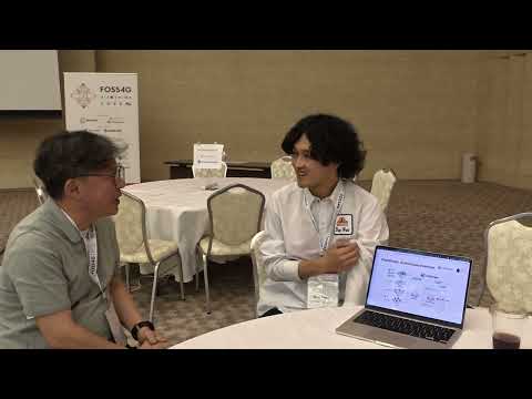
Interview with Yuta Sato, developer of city2graph (1)
▶ Interview with Yuta Sato, developer of city2graph (1)International Conference Center, Himawari · 1 Sep · 1:57
Interview with Yuta Sato, developer of city2graph (2)
▶ Interview with Yuta Sato, developer of city2graph (2)International Conference Center, Himawari · 1 Sep · 0:44
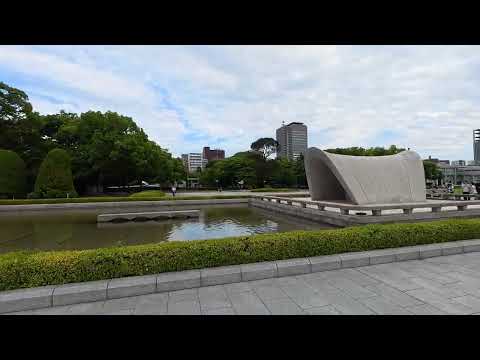
The south lawn of the Peace Memorial Park
▶ The south lawn of the Peace Memorial ParkHiroshima Peace Memorial Park · 1 Sep · 0:54
The axis of the cenotaph
▶ The axis of the cenotaphHiroshima Peace Memorial Park · 1 Sep · 0:45
Along the tree-lined walk
▶ Along the tree-lined walkHiroshima Peace Memorial Park · 1 Sep · 2:13
The footway along Peace Boulevard
▶ The footway along Peace BoulevardHiroshima Peace Memorial Park · 1 Sep · 0:28
The A-Bomb Dome at close range
▶ The A-Bomb Dome at close rangeA-Bomb Dome, Hiroshima · 1 Sep · 1:24
The dome seen from the Motoyasu riverside
▶ The dome seen from the Motoyasu riversideMotoyasu riverside, Hiroshima · 1 Sep · 0:26
The yagura and the bon odori
▶ The yagura and the bon odoriHiroshima Central Park open square · 1 Sep · 0:48
The summer festival across the downtown square
▶ The summer festival across the downtown squareHiroshima Central Park open square · 1 Sep · 3:50
The gala dinner opens
▶ The gala dinner opensGrand Prince Hotel, banquet hall · 2 Sep · 0:23
Greetings from the stage
▶ Greetings from the stageGrand Prince Hotel, banquet hall · 2 Sep · 0:45
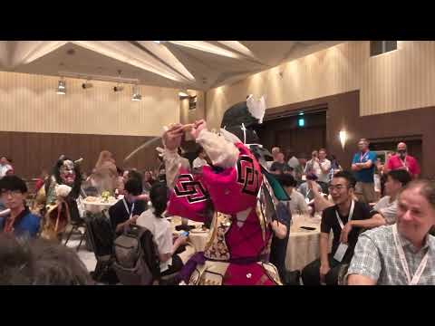
Iwami Kagura (1)
▶ Iwami Kagura (1)Grand Prince Hotel, banquet hall · 2 Sep · 1:19
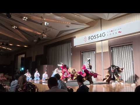
Iwami Kagura — Yamata-no-Orochi
▶ Iwami Kagura — Yamata-no-OrochiGrand Prince Hotel, banquet hall · 2 Sep · 1:29
The performance moves among the tables
▶ The performance moves among the tablesGrand Prince Hotel, banquet hall · 2 Sep · 0:09
The close of the performance
▶ The close of the performanceGrand Prince Hotel, banquet hall · 2 Sep · 0:19
Ramparts and the historic-site panel
▶ Ramparts and the historic-site panelHiroshima Castle, Ninomaru · 3 Sep · 0:50
The path up to the Honmaru
▶ The path up to the HonmaruHiroshima Castle, Honmaru · 3 Sep · 0:49
The wide lawn left on the castle site
▶ The wide lawn left on the castle siteHiroshima Castle, Honmaru · 3 Sep · 0:39
Walking up to the keep
▶ Walking up to the keepHiroshima Castle, the keep · 3 Sep · 1:35
Inside the restored Ninomaru buildings
▶ Inside the restored Ninomaru buildingsHiroshima Castle, Ninomaru · 3 Sep · 0:57
Timber galleries and a model of the castle
▶ Timber galleries and a model of the castleHiroshima Castle, Ninomaru · 3 Sep · 1:33
The closing ceremony — Phoenix Hall
▶ The closing ceremony — Phoenix HallInternational Conference Center, Phoenix Hall · 3 Sep · 2:10

MapLibre Meetup Hiroshima 2026 — the talks in detail

What was presented at the community meetup held on the twelfth-floor observation deck of Orizuru Tower, beside the A-Bomb Dome, on the evening of 3 September after the closing ceremony. It was a free event unconnected to conference registration, sponsored by Re:Earth and conducted in English.

Date Thu 3 Sep 2026, 19:00–21:00 Venue Orizuru Tower, 12th floor, “Hiroshima Hill” Host · sponsor MapLibre community · Re:Earth Admission Free (pre-registration) · 100 places · English
TALK 1

MapLibre in Hiroshima! — State of MapLibre

Yuri Astrakhan (@nyurik) · CC BY 2.0 · 49 slides

A keynote setting out the project's past year along five axes: organisation, products, formats, 3D and community. It opened by retracing, over two slides titled “License is everything” and “The little tweet that could…”, how the community came to fork after Mapbox GL JS changed its licence in 2020 from open source to proprietary. That a single licence clause can redirect an entire ecosystem — and that the response began with one tweet — is the project's starting point.

Organisation — The .ORG

  • The foundation exists solely to support the software projects.
  • The MapLibre Board is fully re-elected every year; it makes financial decisions and is the final arbiter on technical questions.
  • Three layers: MapLibre Team · MapLibre Voting Members · Charter.

The products

  • MapLibre Web (TypeScript) — the map API for web browsers
  • MapLibre Native — native renderers for iOS, Android and desktop
  • Martin Tile Server (Rust) — serves tiles from Postgres, MBTiles and PMTiles

Who is using it

  • Wikipedia (Wikimedia Maps), Amazon logistics, Bing Maps (Microsoft)
  • Ride-hailing services such as Lyft and Grab, and many navigation apps across Europe and Asia
  • Rivian vehicle infotainment, and the OSM survey app StreetComplete

MapLibre GL JS v6 (released)

  • CommonJS → ESM, WebGL 1 support dropped, faster build system
  • Performance work across GeoJSON updates, memory use and tile caching
  • First-class MapLibre Tile (MLT) support, complex-script font support
  • New rendering — global state, rounded corners, data-driven line-dash, colour relief, experimental tile slicing

MapLibre Native

  • Modernised graphics architecture — Vulkan as the default Android backend, a WebGPU backend in progress
  • Terrain3D and advanced terrain rendering
  • Experimental C API (FFI) — Java, Rust, Rust-Python and Zig bindings
  • Lower memory use, better camera and rendering, greater resilience under memory pressure
  • MLT integration (some encodings, FastPFOR among them, not yet supported)

Martin Tile Server — v1, eight years on

  • Written in Rust and presented as the fastest tile server, reaching v1 after more than eight years of development.
  • Backends — PostGIS · MBTiles · COG (Cloud Optimized GeoTIFF) · PMTiles (both files and HTTP buckets), with AWS Lambda execution supported
  • Map support — sprites · fonts · styles · caching · CORS · ETag
  • New — server-side raster rendering, post-processing (mlt↔mvt conversion, hillshading and so on), a rich web UI
  • Adoption as the standard MapLibre tile server is growing.

MLT — the MapLibre Tiles format

  • Up to six times smaller than existing vector tiles, and faster to decode.
  • Column-oriented storage with per-column encoding choices, SIMD optimisation, zero-copy hand-off to the GPU, pre-tessellation
  • Implementations — Rust (encode and decode) · JS (decode) · C++ (decode) · Java (encode and decode)
  • Next — M values carried per vertex (elevation, timestamp, curvature, lane count), arrays and nested structures (multi-value OSM tags), experimental QGIS support
  • Further ideas — routing tiles for offline re-routing (Valhalla), and partial or sparse FST text indexes for offline POI and address search

3D — “3D or not 3D is not the question”

  • 2.5D — extrusion, giving 2D polygons a height and a base elevation
  • True 3D — GLTF-based, with geometry, materials, textures, animation and lighting (the Navara demo)
  • 2.75D — the simplified, fast 3D popularised by Apple and Google; styleable, and part of the MLT 3D proposal
  • What remains is data. Google has GLTF and Cesium, OSM has 2D — how much should be filled in by inference?

Closing — a call to action

  • “Agency” — free and open source software lets us control ourselves.
  • But it does not survive on its own. Companies should establish an internal FOSS fund and, where a project matters to the business, let managers disburse from it easily; verification can be left to an organisation such as Open Collective.
  • Ways in — GitHub Discussions and Issues, Slack (invite link at maplibre.org/community), the social newsletter, and the Technical Steering Committee meeting on the second Wednesday of each month
TALK 2

Writing Code Is Easy. Governing It Is Hard.

Yui Matsumura (yuiseki) · Geolonia, Inc. · subtitled “What I learned from MapLibre and maplibre-native-slint”

A talk that recast the experience of binding MapLibre Native to the Rust GUI toolkit Slint — the maplibre-native-slint work — as a problem of open source governance. Deciding who accepts a contribution, by what procedure, and who maintains it afterwards is far harder than writing the code. Coming after the keynote, it confirmed from a contributor's side why the foundation structure and the technical steering committee exist.

TALK 3

OpenStreetMap Sound Demo

Taro Matsuzawa (@smellman)

A demo in which the buildings of a city rise and fall in real time with the frequency content of music. It treats the map not as a medium for conveying information but as an audiovisual one, and shows how far data-driven styling of vector tiles can be pushed.

How the building heights are animated

  • Frequency data is read from the Web Audio API's AnalyserNode with fftSize = 32, giving 16 bins.
  • Buildings are split into 16 tiers by render_height, each tier added as a separate fill-extrusion layer.
  • Every frame reads dataArray[i] and updates the fill-extrusion-height of layer 3d-buildings-i.
  • Average amplitude drives the HSL hue and intensity passed to setLight, looped continuously via requestAnimationFrame.

Asides

  • To play audio from Archive.org he runs a proxy on his own server to get around CORS (Python: FastAPI + httpx).
  • In VJ mode any source can be used as input via Loopback.app on macOS or PipeWire on Linux.
TALK 4

Open services on open data — what you can use today

Re:Earth (meetup sponsor)

An introduction to free public services built on open data. The point is that they attach directly to a MapLibre style with no key and no account.

  • terrain.reearth.land — global terrain, rendered on request
  • buildings.reearth.land — 2.5D building footprints from Overture, rendered on request
  • papers.reearth.land — basemaps, painted and plain
  • Data — OSM · Overture · Mapterhorn · Protomaps · Natural Earth · NASA Black Marble · ESA WorldCover · EGM2008
  • Licences — MIT · Apache-2.0. Free, and no API key required.

Sources — photographs taken on site (19:04–20:09) and the deck “2026-09 MapLibre @ FOSS4G JP Meetup” (Yuri Astrakhan, CC BY 2.0, 49 slides). Figures and wording follow the slides as presented.

Transcriptions — Text in the photographs

Text carried by slides, monuments and signboards photographed at the venue and around the host city. It includes the closing-ceremony figures, the MapLibre meetup slides, and the full inscriptions — Korean, Japanese and English — of the Monument to Korean Victims and Survivors in the Peace Memorial Park.

The Monument to Korean Victims and Survivors was erected on 10 April 1970 by the Hiroshima Prefectural Branch of the Organization of Korean Residents in Japan. It stood for decades outside the park on the bank of the Honkawa River and was moved inside the Peace Memorial Park in 1999. Its inscription records that roughly one in ten of the 200,000 people Hiroshima lost to the bomb were Koreans.

Monument to Korean Victims and Survivors — “Origin of the Monument”, Korean inscription (pid 169)

Reproduced in the original Korean. The monument's own English text, carved on the same site, appears below.

제2차 세계대전이 끝날 무렵 히로시마에는 약 10만명의 한국인이 군인 군속 징용공 동원학도 일반시민으로서 살고 있었다. 1945년 8월 6일의 원폭투하로 인해 2만여명의 한국인이 순식간에 소중한 목숨을 빼앗겼다. 히로시마시민 20만 희생자수의 1할에 달하는 한국인 희생자수는 묵과할수 없는 숫자이다.

폭사한 이 희생자는 공양도 제대로 받지 못하고 그 영혼은 오랫동안 구중을 헤메이고 있던차 1970년 4월 10일 재일본대한민국거류민단 히로시마현본부에 의해 비참한 죽음을 강요당한 영혼들을 편히 잠들게 하고 원폭의 참사를 두번다시 되풀이 않기를 희구하면서 평화의 땅 히로시마의 일각에 이 비를 건립했다.

고향산천을 그리면서 이국땅에서 폭사한 혼령들을 위로함은 말할것도 없고 아직까지도 이해해 받지 못하고있는 한국인 피폭자의 현상에 대한 관심을 불러 일으켜 하루라도 빨리 양심있는 지원이 실현되기를 바라마지 않는다. 한국인 희생자위령제는 매년 8월 5일 이 장소에서 거행되고 있다.

재일한국청년상공인연합회 및 유지일동

Monument to Korean Victims and Survivors — “慰霊碑の由来”, Japanese inscription (pid 170)

Reproduced in the original Japanese.

第二次世界大戦の終り頃 広島には約十万人の韓国人が 軍人、軍属、徴用工、動員学徒、一般市民として在住していた。1945年8月6日原爆投下により、2万余名の韓国人が一瞬にしてその尊い人命を奪われた。広島市民20万犠牲者の1割に及ぶ韓国人死没者は決して黙過できる数字ではない。

爆死した これら犠牲者は誰からも供養を受けることなく、その魂は永くさまよい続けていたが、1970年4月10日 在日本大韓民国居留民団広島県本部によって悲惨を強いられた同胞の霊を安らげ 原爆の惨事を二度と くり返えさないことを希求しつつ平和の地、広島の一隅に この碑が建立された。

望郷の念にかられつつ異国の地で爆死した霊を慰さめることはもとより 今もなお理解されていない韓国人被爆者の現状に対しての関心を喚起し一日も早い良識ある支援が実現されることを念じる。

韓国人犠牲者慰霊祭は毎年8月5日この場所で挙行されている。

在日本韓国青年商工人連合会及び有志一同

Monument to Korean Victims and Survivors — English inscription (pid 171)

At the end of World War II, there were about 100,000 Koreans living in Hiroshima as soldiers, civilian employees of the army, mobilized students and ordinary citizens. When the atomic bomb was dropped on August 6th, 1945, the sacred lives of more than 20,000 Koreans were suddenly taken from our midst. Of the 200,000 Hiroshima citizens lost to the bomb, approximately 10% were Koreans. This tragic figure cannot be quietly left unnoticed.

The Korean victims were given no funerals or memorial services and their spirits hovered for years unable to pass on to heaven. Then, on April 10, 1970, this monument was erected in this corner of Hiroshima, the City of Peace, by the Hiroshima Prefectural Branch of the Organization of Korean Residents in Japan. This monument was erected in the hope that the souls of our compatriots, brought to misery through force, will be able to rest in peace.

It is also an expression of our demand that the A-bomb tragedy will never be repeated.

We pray, of course, for the solace of those lost souls longing for their homeland, but killed on foreign soil. However, we also pray that the plight of the Korean survivors, poorly understood even today, will emerge into public awareness and that reasonable assistance for these survivors will be provided immediately.

A memorial service for the Korean victims of the bomb is held here every year on August 5th.

The Junior Federation of Commerce and Industry of Korean Residents in Japan and Concerned Volunteers

Downtown street sign — “社会的なルールです / Hiroshima — Let's Keep it Clean!” (pid 28)

社会的なルールです — 広島市は、地域の皆さんとの協働によってきれいで快適なまちづくりを進めます。

This area is designated by the “Hiroshima Litter Prevention Ordinance” as both a “Town Beautification Area” and a “No-Smoking Area.” (The sign shown at upper right is displayed on the street.) Penalties apply for performing any of the following activities in this area. In public outdoor areas: 1. Smoking in areas away from designated ashtrays. 2. Littering (disposing of cigarette butts, empty cans, etc. by throwing them on the street.) 3. Failure to pick up after your dog. In any outdoor area: 4. Graffiti. The penalty for violating 1-3 is a fine of 1,000 yen. The penalty for violating 4 is a fine of up to 50,000 yen.

(Lower panel) 美化推進区域および喫煙制限区域図 Town Beautification and No-Smoking Area — legend: Public Toilet · Trash Can · Smoking Area · Current Location · Town Beautification and No-Smoking Area / Contact: 広島市環境局業務部業務第一課 TEL (082) 504-2098

Plaque of the “Fountain of Prayer”, Peace Memorial Park (pid 168)

平和の泉 — 昭和35年9月 · 広島青年会議所 創立10周年記念施設

(Note) Built in September 1960 by the Hiroshima Junior Chamber to mark its tenth anniversary. The fountain sends water through the park in memory of those who died searching for water after the bombing.

FOSS4G HIROSHIMA 2026 registration notice (pid 30)

7F Registration — Please take the elevator to the 7th floor. / FOSS4G HIROSHIMA 2026

Title slide of the oral presentation (pid 146)

FOSS4G 2026 · Hiroshima · Academic Track — An Open Geospatial Framework for Proximity-Based Community Planning: Integrating Mobility Based Community Detection, Multimodal Accessibility and Facility Allocation Optimisation

1 September 2026 · Junyoung CHOI¹ · Sunyong EOM² · Jiho YEO³ · Yuri LEE¹ (¹The Seoul Institute, ²Hanyang University, ³Gachon University)

FOSS4G HIROSHIMA 2026 closing panel — panel and questions (pid 520·522·523)

Panel Discussion — “What the Field Needs — Technology, Capacity, and People in the Age of Digital Public Goods”

Panel: Yuko Yokoi (UNDP) · Chisa Mikami (UNITAR) · Jumpei Takami (UNOOSA) · Rei Kasai (UNHCR)

Question 1. If developers around the world could start working for your organization tomorrow — what would you ask them to do first?

Question 2. Tell us about a moment when training or support really took root — when it kept working after the project ended. What was different?

FOSS4G HIROSHIMA 2026 closing ceremony — “This week in numbers” (pid 524·526·527)

828 people came to Hiroshima. (841 people registered.)

65 countries and regions. (746 people told us where they are from. More than half of them came from outside Japan.)

348 presentations — General session talks 237 · Lightning talks 41 · Posters 37 · Sponsor talks 26 · Interactive demonstrations 7, and 7 community events.

450 people joined Gala Dinner.

FOSS4G HIROSHIMA 2026 closing ceremony — Academic Track results (pid 528·529)

93 · 72 · 52

93 submissions received. 72 accepted. 52 full papers in the final proceedings.

Published Open Access, supported by the ISPRS Inter-Commission Working Group IV / III / II, “Openness in Geospatial Science and Remote Sensing.”

Online now. Free. For anyone. Permanently.

Edited by Toshikazu Seto, Nobusuke Iwasaki and Mitsunori Ueda.

Proceedings — isprs-archives.copernicus.org

Announcement of the next host (pid 530)

FOSS4G 2027 — 23 – 27 August 2027, Bristol, UK

OSGeo:UK · University of Bristol

https://2027.foss4g.org · #foss4g:osgeo.org [matrix] · info.2027@foss4g.org

Closing-ceremony slide behind the volunteers (pid 536)

Yokohama to Osaka, 2005 — One phone call. Three years later, OSGeo existed.

MapLibre Meetup Hiroshima 2026 — presentation screens (pid 546·551·560·562·565·567·569·570)

MapLibre in Hiroshima! — Yuri Astrakhan (@nyurik) · CC BY 2.0 · Map Data OpenStreetMap, Style OpenMapTiles

The .ORG — Exists to support the software projects. MapLibre Board, fully re-elected yearly. Makes financial decisions, final arbiter technical decisions. MapLibre Team · MapLibre Voting Members · Charter.

“Writing Code Is Easy. Governing It Is Hard. — What I learned from MapLibre and maplibre-native-slint” · Yui Matsumura / yuiseki, Geolonia, Inc.

“OPENSTREETMAP SOUND DEMO” · Taro Matsuzawa (@smellman)

HOW THE BUILDING HEIGHTS ARE ANIMATED — Frequency data using fftSize = 32 → 16 bins on the AnalyserNode. Buildings are split into 16 tiers by render_height, each added as a separate fill-extrusion layer. Each frame reads dataArray[i] and updates the fill-extrusion-height of layer 3d-buildings-i. The average amplitude drives changes in the HSL hue and intensity of setLight. Looped continuously via requestAnimationFrame.

ANOTHER TOPIC — I'm running a proxy on my own server to resolve CORS issues in order to play music from Archive.org. (Python: FastAPI + httpx) VJ mode: You can use any source via Loopback.app (macOS) or PipeWire (Linux).

Open services on open data — OSM · Overture · Mapterhorn · Protomaps · Natural Earth · NASA Black Marble · ESA WorldCover · EGM2008 · libmypaint / ezu / hokusai — MIT · Apache-2.0 — free · no key

In your MapLibre, today — terrain.reearth.land (Global terrain, rendered on request) · buildings.reearth.land (2.5D footprints from Overture, rendered on request) · papers.reearth.land (Basemaps — painted, and plain)

Hiroshima Museum of Art signage (pid 466·513)

特別展会場 Special exhibition — 誕生70周年記念 ミッフィー展 第1会場 Room 1 (11 July – 8 September 2026)

ひろしま美術館 HIROSHIMA MUSEUM OF ART — コレクション展Ⅱ・フランス近代絵画 / Collection Gallery: French Paintings

Banner at the Ninomaru, Hiroshima Castle (pid 465)

広島城二の丸復元建物 — The Restored Buildings at Ninomaru of Hiroshima Castle

ミュージアムショップはこちら — The Museum Shop is Here

What the four days added up to

How a host city defines a conference — these four days carry the answer.

Talks survive as proceedings

The Academic Track closed with 93 submissions, 72 acceptances and 52 full papers, all published Open Access and permanently through the ISPRS Archives. The principle that a presentation should not end at the podium but persist in citable form runs through the whole operation. That an open source community event maintains a separate track with academic review is what carries the field's results into policy and research literature.

International organisations attend as users

The closing panel was made up of practitioners from UNDP, UNITAR, UNOOSA and UNHCR. Open source geospatial tools have become working instruments in humanitarian and development operations, and what these organisations care about is not features but capacity and the durability of funding — a point made repeatedly. The format itself, in which a technical community and international agencies trade requirements in the same room, is an asset of this conference.

A memorial landscape as convention infrastructure

The main venue, the Hiroshima International Conference Center, sits on the axis of the Peace Memorial Park, built as one body with the Peace Memorial Museum. Participants walk past the cenotaph and the A-Bomb Dome between sessions. Putting a place of memory and an international conference facility on the same site works as a device that delivers the city's message to every delegate.

Streetcars set the terms of movement

The airport has no rail link and depends on limousine buses, but inside the city the largest streetcar network in Japan holds the venue, the hotels and the shopping streets within two or three stops. Fare products aimed at short-stay visitors — the Hiroden eight-hour pass among them — run alongside it. That a delegate's day was handled by the existing public network without dedicated shuttles was a practical condition of the host city's suitability.

A large disused site, converted

A welcome reception for an international conference and a citizens' bon odori ran the same evening in the downtown parks made from the old municipal stadium site. Returning a major disused site to squares and commercial uses shows up as the density that lets both be accommodated at once.

Open space inherited from a castle

The Hiroshima Castle grounds and Central Park were lost entirely to the bomb, yet were never consumed by redevelopment; they remained as the frame for parks and cultural facilities. The castle site, Gokoku Shrine, Shukkeien Garden, the Prefectural Art Museum and the Hiroshima Museum of Art stand within walking distance of one another, making the northern centre a single cultural cluster. That the concrete keep of 1958 and the timber restoration of the Ninomaru (1989–1994) coexist on one site is itself a record of how restoration philosophy changed.

The community continues after the official programme

On the evening the closing ceremony ended, a free MapLibre meetup was held on the twelfth floor of Orizuru Tower beside the A-Bomb Dome — talks heard against a night skyline rather than inside a convention hall — while the Academic Track's 52 papers go on being available Open Access through the ISPRS Archives. That the programme inside paid registration and the community activity outside it run continuously through the same city is characteristic of how FOSS4G operates.

Attended and recorded by Junyoung Choi (The Seoul Institute) · 31 Aug (Mon) – 3 Sep (Thu) 2026 · Hiroshima, Japan
106 photographs · 24 on-site videos · 26 recorded stops · full transcriptions of slides, monuments and signboards
Conference — FOSS4G 2026 Hiroshima (30 Aug – 5 Sep 2026, Hiroshima International Conference Center) · Oral presentation Tue 1 Sep 14:30, Cosmos 1, Academic Track
Academic Track proceedings — Open Access via ISPRS Archives (isprs-archives.copernicus.org) · Next edition FOSS4G 2027 Bristol (23–27 Aug 2027)